Catalog Archive
Auction 117, Lot 99

"Pascaarte vande Noorder Zee custen van America, vande West-hoeck van Ysland doorde Straet Davis en Hudson, tot aen Terra Neuf", Keulen, Johannes van

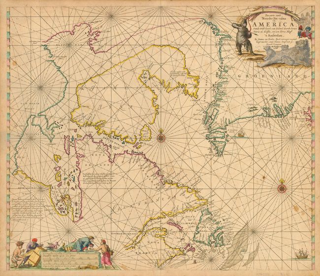
Subject: Canada and Greenland

Period: 1687 (published)

Publication: De Nieuwe Groote Lichtende Zee-Fackel, Tweede Deel

Color: Hand Color

Size:
23.5 x 19.7 inches
59.7 x 50 cm
Download High Resolution Image
(or just click on image to launch the Zoom viewer)

This is a great sea chart of Hudson Bay, Labrador, Newfoundland, James, Island and Greenland. Compass roses, loxodromic lines, and ships decorate the oceans and both the title and distance scale are embellished with scene of hunters, trading, Native Americans and animals. The title cartouche is truly astonishing, with a hunter fully dressed in fur hunting a polar bear family with bow and arrow. This map was first drawn in 1680 and is based on Doncker's final chart of Hudson Bay and the Arctic, with nearly identical cartouches. This is the second state with the "met Priviligie voor/ 15 Iaar" added to the cartouche and the error "Teppa Nova" in Newfoundland, instead of Terra Nova.

References: Kershaw #206; Phillips (A) #3444, Vol. 2, #43.

Condition: B

Evenly toned with a few, light stains in map. The paper is very thick and strong, and with good, original margins.

Estimate: $800 - $1,200

Sold for: $600

Closed on 12/6/2006

Archived