Catalog Archive
Auction 117, Lot 98

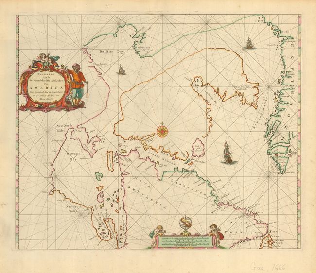
"Paskaert Zijnde de Noordelijckste Zeekusten van America Van Groenland door de Straet Davis en de Straet Hudson tot Terra Neuf", Goos, Pieter

Subject: Canada and Greenland

Period: 1666 (circa)

Publication: De Zee-Atlas, Ofte Water-Woereld…

Color: Hand Color

Size:
21.2 x 17.4 inches
53.8 x 44.2 cm
Download High Resolution Image
(or just click on image to launch the Zoom viewer)

Fascinating and uncommon sea chart covering the approaches to Hudson Bay and the fabled Northwest Passage. Johannes van Loon issued an identical map this same year; no one knows whose was first, although it is considered that Goos' map is derived from van Loon. The cartography of this chart is based on various sources, including Hondius' map of North America and Jansson's map of the North Pole, and Greenland is shown with the three-island configuration that began with Sanson. Hudson's Bay is named as a tiny, little cove between James Bay and a large, fictitious bay called The Great Bay. The map is decorated with rhumb lines, ships and a compass rose as well as a decorative title and distance scale cartouche.

References: Burden:#386; Kershaw: #197.

Condition: A

Printed on fine, strong paper with a few pinhole-sized wormholes in the lower, blank margin. Lovely old color.

Estimate: $1,100 - $1,800

Sold for: $850

Closed on 12/6/2006

Archived