Catalog Archive
Auction 117, Lot 88

"A Map of North America; Published under the Patronage of the Duke of Orleans by D'Anville", Harrison, John

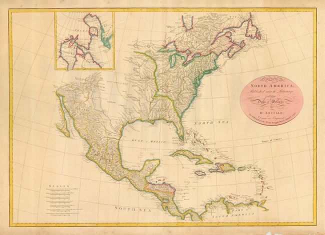
Subject: North America

Period: 1791 (dated)

Publication:

Color: Hand Color

Size:
28 x 19.7 inches
71.1 x 50 cm
Download High Resolution Image
(or just click on image to launch the Zoom viewer)

This is striking and very scarce map of North and Central America with the West Indies. Names Tecas for Texas and the entire Northwest is noted as parts unknown. Many place names, Indian tribes, and forts are located. The Colorado River is here called the R. Colorado of Martyes. The map is inset with a small detail of Hudson and Baffin's Bay. This map is a reduced version based upon D'Anville's map of 1746 with the names translated into English. D'Anville was Royal Geographer and Cartographer to the King of France, and produced under the patronage of his brother. D'Anville followed Delisle as the chief proponent of scientific cartography, and his influence on his contemporaries was profound. Because he had direct access to the many official French records of North America his maps are known for their excellent detail and clearly presented information. Drawn and engraved for J. Harrison, No. 115, Newgate Street, January 1, 1791. A great addition to any collection on North American exploration.

References:

Condition: A

Very good with some chips and toning in the blank margin. Nice old color.

Estimate: $1,200 - $1,500

Unsold

Closed on 12/6/2006

Archived