Catalog Archive
Auction 117, Lot 782

"Mar di India", Jansson, Jan

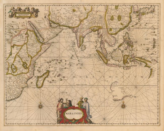
Subject: Indian Ocean

Period: 1650 (circa)

Publication:

Color: Hand Color

Size:
22 x 17 inches
55.9 x 43.2 cm
Download High Resolution Image
(or just click on image to launch the Zoom viewer)

Lovely chart of the Indian Ocean, from the Cape of Good Hope and the Arabian Sea to the Malay Archipelago, Japan and Korea, which is noted here as an island. China is dominated by several large, spurious lakes. Western Australia is nearly complete, but the Cape York peninsula is assumed to be part of New Guinea. Although this map was first printed in 1650, it includes only the discoveries made up to 1628. This is the French text edition.

References:

Condition: B

Classic, original color. The map is generally toned, with light foxing and two tiny wormholes. Centerfold split about 3" in map without any loss.

Estimate: $1,200 - $1,600

Sold for: $1,200

Closed on 12/6/2006

Archived