Catalog Archive
Auction 117, Lot 725

"Napthali", Fuller, Thomas
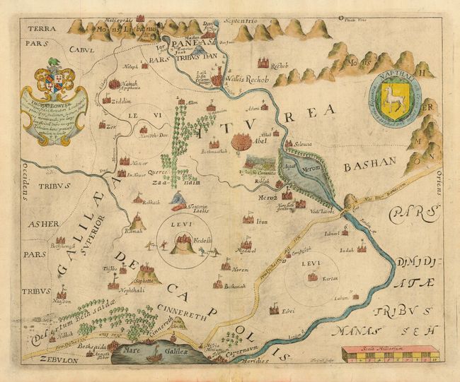
Subject: Holy Land

Period: 1650 (published)

Publication: A Pisgah-Sight of Palestine…

Color: Hand Color

Size:
13.5 x 10.9 inches
34.3 x 27.7 cm
Download High Resolution Image
(or just click on image to launch the Zoom viewer)

This delightfully illustrated map covers the territory of Napthali, one of the twelve tribes of Israel. Bounded by the Lebanon Mountains in the north to the Sea of Galilee, the map is roughly centered on Kadesh, its most prominent town and the Jordan River is prominently depicted. The map is filled with pictorial illustrations and is embellished with a coat of arms and dedication to Thomas Bowyer and the shield of the Tribe of Napthali. Engraved by Thomas Cross.

Thomas Fuller (1608-1661) was a respected English clergyman who wrote several books on the history and geography of the Holy Land. His A Pisgah-Sight of Palestine, published in 1650, was a geographical description of the Holy Land with special reference to biblical history. Fuller financed the book by dividing it into sections and finding sponsors for each one. To acknowledge the patrons, all maps contained decorative cartouches with the sponsor's coat of arms and a dedication to him.

References:

Condition: B

Tissue repair of bottom centerfold filling a tiny worm hole. Some plate ink residue throughout. Brown paper hinges in top margin.

Estimate: $275 - $325

Sold for: $200

Closed on 12/6/2006

Archived