Catalog Archive
Auction 117, Lot 686

"Carte des Isles de Malte du Goze et du Cuming avec la position des Batteries et des Redoutes faites pair la deffence de la Coste", Berey, Charles

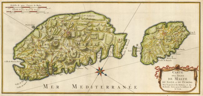
Subject: Mediterranean - Malta

Period: 1726 (circa)

Publication:

Color: Hand Color

Size:
19.6 x 9.1 inches
49.8 x 23.1 cm
Download High Resolution Image
(or just click on image to launch the Zoom viewer)

This is a handsome map of the islands of Malta and Gozo with excellent detail of the towns, fortifications, roads and anchorages. After the devastating earthquake of 1693, there was a massive effort to rebuild and strengthen the existing coastal defenses by constructing new redoubts and entrenchments. The map shows these fortifications along with the cities, villages and roads on the islands. The bold compass rose oriented the map with north to the lower right corner. A drape-style cartouche encloses the title.

References:

Condition: A

Issued folding, now pressed. Binding trim replaced with repaired binding tear just entering neatline at lower left.

Estimate: $600 - $800

Sold for: $550

Closed on 12/6/2006

Archived