Catalog Archive
Auction 117, Lot 374

"A New and Complete Map of the West Indies Comprehending all the Coasts and Islands Known by That Name", Laurie & Whittle

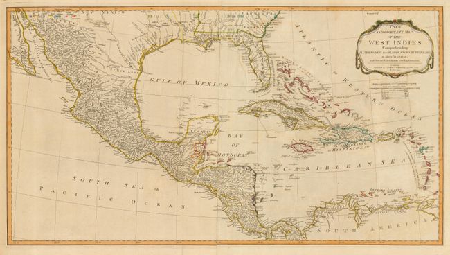
Subject: Gulf of Mexico and Caribbean

Period: 1794 (dated)

Publication: A New and Elegant Imperial Sheet Atlas

Color: Hand Color

Size:
33.5 x 18.3 inches
85.1 x 46.5 cm
Download High Resolution Image
(or just click on image to launch the Zoom viewer)

This large, two-sheet, chart of the Gulf of Mexico and the Caribbean and Bahama Islands is based on the cartography of D'Anville. It shows the colonial possessions in the region with a color key below the title cartouche. The region is dominated by Spain with possessions including Florida and the formerly French Louisiana. The other colonies include, British, French, Dutch, Danish and the Swedish Mosquito Shore of Honduras. The large cartouche is draped in a garland.

References: Phillips (A) #6009-64.

Condition: A

Original outline color. Some faint offsetting, still overall very good.

Estimate: $650 - $750

Sold for: $450

Closed on 12/6/2006

Archived