Catalog Archive
Auction 117, Lot 347

"Millroy & Egan's Indexed Sectional Map of Washington",
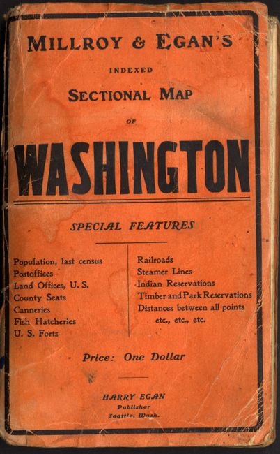
Subject: Washington

Period: 1901 (dated)

Publication:

Color: Printed Color

Size:
50 x 33 inches
127 x 83.8 cm
Download High Resolution Image
(or just click on image to launch the Zoom viewer)

Large, colorful and informative map of the state of Washington. This folding map has detail of the towns, roads, railroads, proposed railroads, steamship routes, wagon and post roads. There is a table at the bottom with a color-coded table for gold, silver, coal, iron and copper mines, canneries, fish hatcheries and Indian reservations. At left is information on the state's commerce, climate, education and more. At right is an extensive table giving hundreds of towns and villages, all with population and keyed to the map. Mt. Rainier National Park is here named Washington National Park. Published by Harry Egan. Folds into orange paper wrappers, measuring 4.5 x 7".

References:

Condition: B

Map with some toning along folds and a couple of separations at fold intersections, as is typical for these maps. A few scattered stains, primarily confined to margins. Wrappers are stained and slightly loose.

Estimate: $120 - $150

Sold for: $180

Closed on 12/6/2006

Archived