Catalog Archive
Auction 117, Lot 346

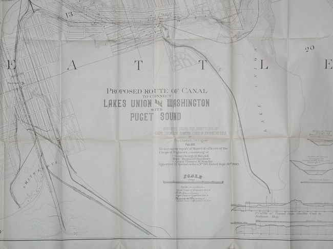
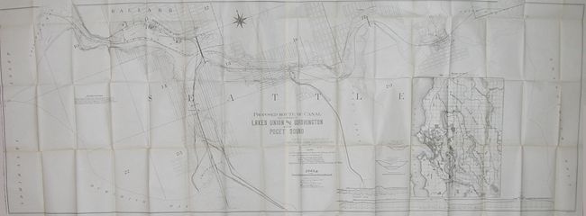
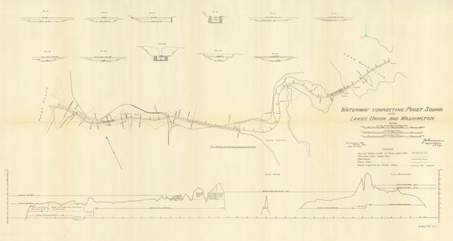
"[Lot of 2] Proposed Route & Canal to Connect Lakes Union and Washington with Puget Sound [and] Waterway Connecting Puget Sound with Lakes Union and Washington", U.S. Corps of Engineers

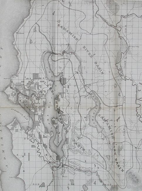
Subject: Washington, Seattle

Period: 1891-1902 (dated)

Publication: House Doc. 40, 52nd Cong., 1st Sess. [and] H Doc 335, 57th Cong. 1st Sess

Color: Black & White

Size:
70.8 x 25.8 inches
179.8 x 65.5 cm
Download High Resolution Image
(or just click on image to launch the Zoom viewer)

A great pair of maps that show the efforts to build a canal between Puget Sound and the lakes of Union and Washington in Seattle. The canal was first suggested by Thomas Mercer in 1854. After the failure of several private efforts, in 1917 the U.S. Army Corps of Engineers under Gen. Hiram M. Chittenden began construction.

The first is a remarkably detailed map with early plans for the canal. The title continues "...Surveyed under the Direction of Capt. Thomas Symons, Corps of Engineers U.S.A. by Philip G. Eastwick Civil Engineer Feb. 1891." It is an enormous lithographed map printed on two joined sheets, as issued. The main map shows the planned canal and locks between Union Bay, Lake Union, Salmon Bay, and on to Puget Sound at Shilshole Bay. Of historical interest is the second proposed canal from Salmon Bay to Smith's Cove on the sound; a route that was not built. With a large inset map of the Seattle metropolitan area. Profiles along bottom detail the elevation changes and required locks for the Smith's Cove to Salmon Bay canal, and the Shilshole Bay to Lake Washington canal. Size is given above.
The second map shows a refined version and the progress in planning the canal ten years later. The chart shows a very precise path with exact benchmarks, curve radii, and more. Above are numerous cross-sections and across the bottom is an elevation showing the entire waterway in profile. (30" x 14")

References:

Condition: A

Both are folding, as issued. The first with a few fold intersection splits and trace of toning, still very good for a map of this size. The second is very nice with no splits and just a faint hint of fold toning.

Estimate: $200 - $250

Sold for: $375

Closed on 12/6/2006

Archived