Catalog Archive
Auction 117, Lot 32

"Chica sive Patagonica et Australis Terra", Wytfliet, Cornelis
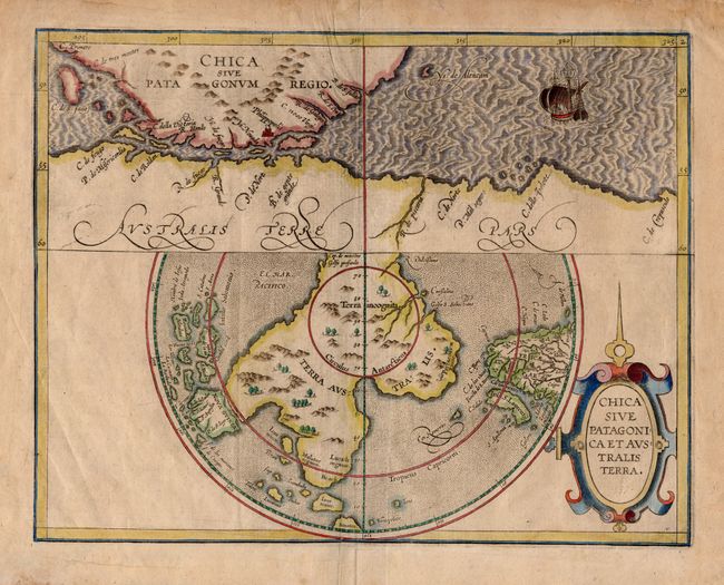
Subject: Antarctica

Period: 1598 (circa)

Publication: Descriptionis Ptolemaicae Augmentum

Color: Hand Color

Size:
11.5 x 9 inches
29.2 x 22.9 cm
Download High Resolution Image
(or just click on image to launch the Zoom viewer)

This is a rare, early map featuring Terra Australis, the great southern landmass thought to cover the South Pole and incorporate what would later be discovered to be Australia. The map is divided into two parts. The upper section shows the tip of South America with the Spanish colony of Philippopolis, and the Strait of Magellan that separates it from Terra Australis. The lower map is presented on a polar projection that shows the huge Terra Australis, with promontories reaching towards Africa, Java and New Guinea. The kingdoms of Meletur, Lucach and Psitacorum (Land of the Parrots), and the place name Beach are located; nomenclature that continues to appear on subsequent maps of Australia. The sea is stipple engraved and includes an image of Magellan's ship Victoria entering the strait, which is named for him. It is further ornamented with a fine strapwork title cartouche. This is the later state with the date removed, but still visible in the cartouche.

References: Tooley (Australia) #1430; Clancy #8.2.

Condition: A

Toned, darker in blank margins. Couple of printer's creases near centerfold. Some minor repairs in margins.

Estimate: $1,300 - $1,500

Sold for: $1,200

Closed on 12/6/2006

Archived