Catalog Archive
Auction 117, Lot 316

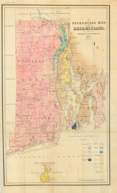
"A Geological Map of Rhode Island", Jackson, Charles T.

Subject: Rhode Island

Period: 1840 (dated)

Publication: Report of the Geological and Agricultural Survey of the State of Rhode-Island…

Color: Hand Color

Size:
12 x 20 inches
30.5 x 50.8 cm
Download High Resolution Image
(or just click on image to launch the Zoom viewer)

This is the first geological map of Rhode Island. Although primarily geologic, it still has a good deal of topographical detail, including towns, boundaries, villages, railroads, rivers, ponds, etc. Full hand color illustrates the thirteen geological features as identified in the key. Engraved on stone by C. Cook, Boston.

References:

Condition: B+

Issued folding. A great example on thin banknote style paper with wide margins. Fine coloring and crisp impression. A little light foxing or toning, else near fine.

Estimate: $150 - $200

Unsold

Closed on 12/6/2006

Archived