Catalog Archive
Auction 117, Lot 260

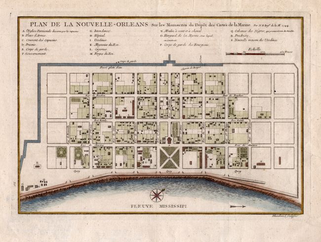
"Plan de la Nouvelle Orleans. Sur les Manuscrits du Depot des Cartes de la Marine", Bellin, Jacques Nicolas

Subject: Louisiana, New Orleans

Period: 1744 (dated)

Publication:

Color: Hand Color

Size:
11 x 7.5 inches
27.9 x 19.1 cm
Download High Resolution Image
(or just click on image to launch the Zoom viewer)

Attractive plan of the city of New Orleans detailing the city center, including Bourbon Street, with individual buildings depicted and keyed to a list under the title. Locates the quay along the Mississippi River, the canal, government buildings, church, prison, hospital, monastery, and army & navy quarters. Bellin's plan was first issued in Charlevoix's History and General Description of New France in 1742 with later versions, such as this one that was engraved by Dheulland, published in several versions. The plan became the standard map of New Orleans throughout the eighteenth century.

References: cf Lemmon #171.

Condition: A

Estimate: $300 - $350

Sold for: $220

Closed on 12/6/2006

Archived