Catalog Archive
Auction 117, Lot 177

"Zee en Land-Togten der Franszen Gedaan na, en in't Americaans Gewest van Florida", Aa, Pieter van der

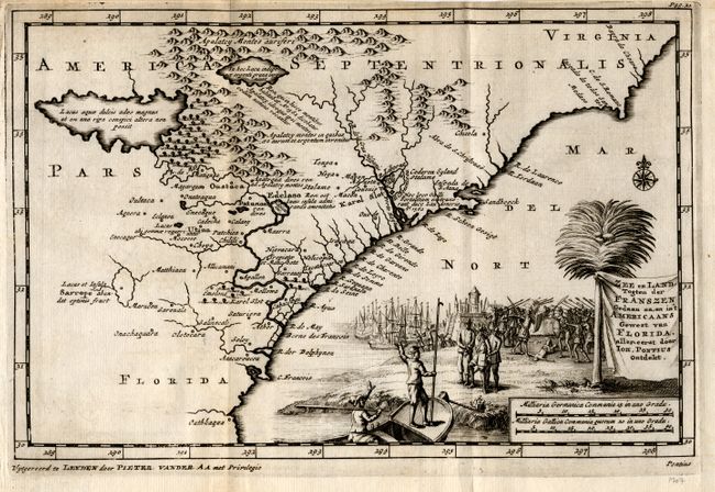
Subject: Colonial Southeast United States

Period: 1707 (published)

Publication: Naaukerige Versameling

Color: Black & White

Size:
9.1 x 6 inches
23.1 x 15.2 cm
Download High Resolution Image
(or just click on image to launch the Zoom viewer)

Outstanding small map of the Southeast, based on the Mercator/Hondius prototype. Much of the geography is based the accounts of John Lederer, who described large interior lakes, an area of savanna at the foot of the Apalatcy Montes auriferi, and a desert region. The two French forts built by Ribaut in 1562 and Laudoniere in 1564 are labeled Karel Slot. The map is beautifully engraved with a large pictorial title cartouche depicting the landing of Ponce de Leon and a battle scene with the natives.

References: Cumming (SE) #143.

Condition: A

Nice impression with slight plate ink residue. Narrow, original margins at top and binding side.

Estimate: $700 - $800

Sold for: $600

Closed on 12/6/2006

Archived