Catalog Archive
Auction 117, Lot 176
"A New Map of Carolina", Morden, Robert
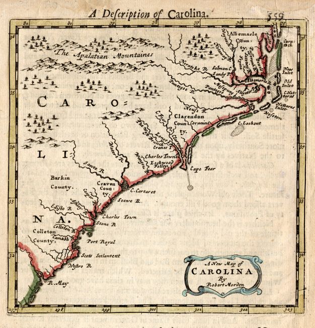
Subject: Colonial Southeast United States
Period: 1688 (circa)
Publication: Geography Rectified
Color: Hand Color
Size:
5 x 5 inches
12.7 x 12.7 cm
Download High Resolution Image
(or just click on image to launch the Zoom viewer)
(or just click on image to launch the Zoom viewer)