Catalog Archive
Auction 117, Lot 149

"Die Vereinigten Staaten von Nordamerika…", Schneider and Weigel

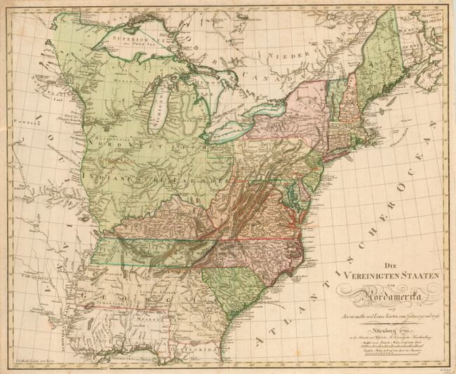
Subject: Eastern United States

Period: 1799 (dated)

Publication:

Color: Hand Color

Size:
25.5 x 21 inches
64.8 x 53.3 cm
Download High Resolution Image
(or just click on image to launch the Zoom viewer)

This is a very rare, separately issued, German map of the United States based on Arrowsmith and Lewis' maps of 1795 and 1796. The map is identical to the rare Sotzmann map of 1804 with the same title, and it appears to be from the same plate with the imprint and date being the only difference. This was published by the Schneider and Weigel publishing house, who published many of Sotzmann's maps in Nuremburg. The new Tennasee Gouvernment is shown and Georgia is portrayed with a large and unusual configuration due to the Spanish claims on the West Florida region. The northwest portion shown here extends from the Ohio River to the Mississippi up to Canada and is shown as Native American territory. The future Minnesota is beset by a region called Mosquito Land Shaft. Our research only located examples in the British Library and the Yale Map Collection. This map would be an important addition to any collection of the United States.

References: McCorkle #799.11.

Condition: B

Printed on strong paper with beautiful original color. A bit of light foxing, mostly in margins. Some hinge remnants on the verso.

Estimate: $3,000 - $3,250

Sold for: $2,400

Closed on 12/6/2006

Archived