Catalog Archive
Auction 117, Lot 10

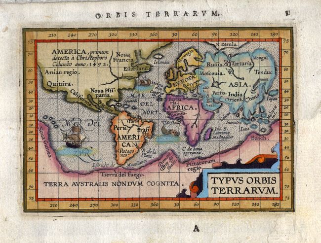
"Typus Orbis Terrarum", Ortelius/Coignet
Subject: World

Period: 1612 (circa)

Publication: Epitome Theatri Orbis Terrarum…

Color: Hand Color

Size:
4.8 x 3.2 inches
12.2 x 8.1 cm
Download High Resolution Image
(or just click on image to launch the Zoom viewer)

This is the first miniature world map presented on Mercator's projection. It depicts the large southern continent and is enclosed in a wide border marking the degrees of latitude and longitude. A notation in North America notes its discovery by Christopher Columbus in 1492. The stippled sea features two sailing ships and a sea monster. This miniature map was engraved by the brothers Ambrose and Gerdinand Arsenius who had been assistants to Frans Hogenburg and thus co-engravers of Ortelius' folio Theatrum. This series of maps was accompanied by text by Michel Coignet and was published by Johann Keerburgen. Latin text on verso.

References: Shirley #230; King (2nd ed.) p. 87.

Condition: A

Estimate: $700 - $800

Sold for: $500

Closed on 12/6/2006

Archived