Catalog Archive
Auction 116, Lot 886

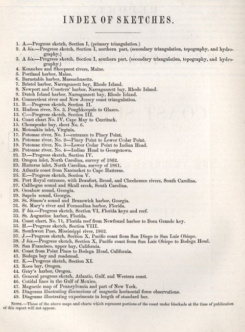
"Report of the Superintendent of the Coast Survey … during the Year 1862", U.S. Coast Survey

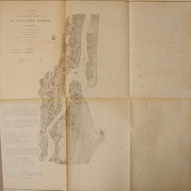
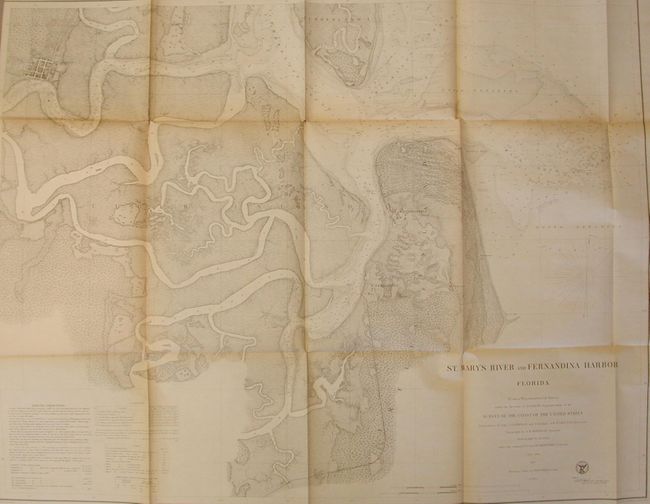
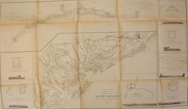
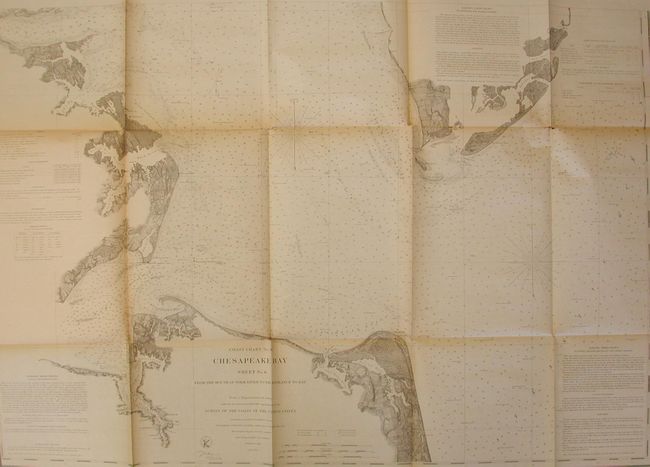
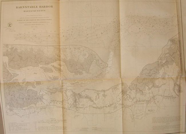
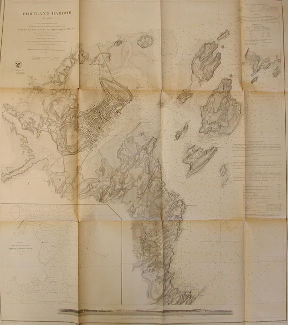
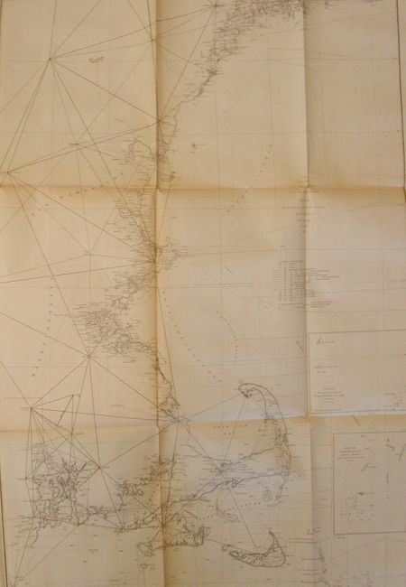
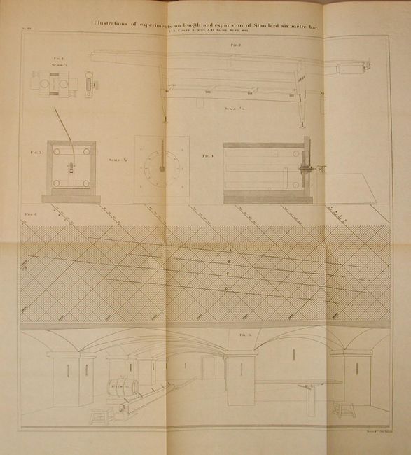
Subject: Exploration and Surveys

Period: 1864 (dated)

Publication:

Color: Black & White

Size:
9 x 11.5 inches
22.9 x 29.2 cm
Download High Resolution Image
(or just click on image to launch the Zoom viewer)

This annual report by the Coast Survey is complete and contains forty-two folding charts and sketches. The chart index calls for 49 charts, but seven were suppressed due to the Civil War blockade as indicated at the bottom of the index. The maps suppressed are: Potomac River, Numbers 1 through 4; Ossabaw sound, Georgia; Sapelo sound, Georgia; and St. Simon's sound and Brunswick harbor, Georgia. These were of the Georgia coast and the Potomac river. Hardbound in green cloth, 434 pp. A better than average example for these reports with some very desirable charts. We have not opened or listed every chart - just the more important ones, ignoring the skeleton sketches and triangulations. All are in very good condition with light fold toning or occasional small fold intersection split, unless noted otherwise. The charts examined include:

1) Kennebec and Sheepscot Rivers Maine. Good with occasional toning and fold intersection splits.
2) Portland Harbor Maine. Very light toning, nearly very good.
3) Barnstable Harbor Massachusetts.
4) Bristol Harbor Rhode Island. Fine.
5) Coasters Harbor and Approaches Rhode Island. Very good with close trimming at top, as issued.
6) Harbor of Refuge Dutch Island Harbor Marrageansett Bay Rhode Island.
7) Preliminary Chart of Hudson River sheet No. 3 From Poughkeepsie to Glasco New York.
8) General Chart of the Coast No. IV From Cape May to Cape Henry.
9) Coast Chart No. 36 Chesapeake Bay Sheet No. 6 From the Mouth of York River to the Entrance to the Bay.
10) Metomkin Inlet Virginia.
11) Oregon Inlet N. Carolina. Fine.
12) Preliminary Chart of Hatteras Inlet North Carolina.
13) Atlantic Coast of the United States (in four sheets) Sheet No. II Nantucket to Cape Hatteras.
14) Coast of South Carolina From Charleston to Hilton Head. This chart has several insets showing military fortifications with sea views. This fine chart does not match to title in the index, which calls for Progress Sketch No. V.
15) Preliminary Chart of Port Royal Entrance Beaufort Board and Chechessee Rivers South Carolina.
16) Preliminary Chart of Calibogue Sound and Skull Creek forming inside passage from Tybee Roads to Port Royal Sound South Carolina.
17) St. Mary's River and Fernandina Harbor Florida.
18) Preliminary Chart of St. Augustine Harbor Florida. Near fine.
19) Preliminary Coast Chart No. 71 Florida Reefs from Newfound Harbor Key to Boca Grande key. Near fine example.
20) Plan of Fort Jackson Showing the effect of the Bombardment by the U.S. Mortar Flotilla and Gunboats April 18th to 24th 1862. On sheet with two other.
21) South West Pass of the Mississippi River.
22) Upper Part of San Francisco Bay California.
23) Preliminary Chart of the Pacific Coast from Point Pinos to Bodega Head California.
24) Bodega Bay California. Near fine.
25) Preliminary Chart of Entrance to Koos Bay Oregon.
26) Preliminary Chart of Gray's Harbor Washington Ter.
27) Sketch Showing the Progress of the Survey on the Atlantic Gulf of Mexico and Pacific Coast of the United States.

References:

Condition: B

The maps are generally in very good condition as noted. The covers have some wear and tears at the top of the spine, but is basically sound with firmly attached covers.

Estimate: $500 - $600

Sold for: $375

Closed on 9/20/2006

Archived