Catalog Archive
Auction 116, Lot 469

"Freti Danici Or Sundt Accuratissima Delineatio cum Regis Sueciae, Daniae, et Hollandia", Anon.

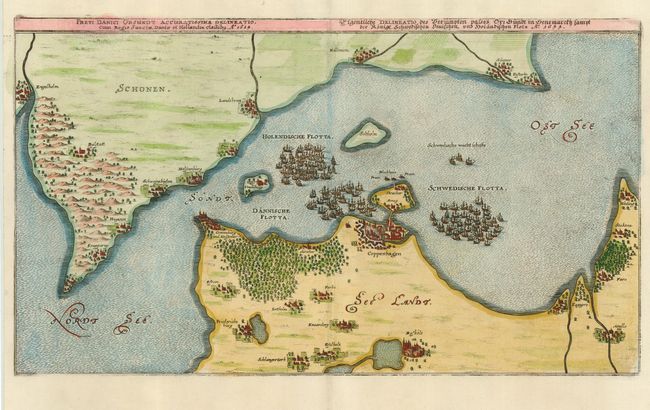
Subject: Denmark and Sweden

Period: 1700 (circa)

Publication:

Color: Hand Color

Size:
14.6 x 8.3 inches
37.1 x 21.1 cm
Download High Resolution Image
(or just click on image to launch the Zoom viewer)

This finely engraved plan displays the Oresund, the strait that separates the Danish island Zealand from the southern Swedish province Scania, and controls traffic between the North Sea and the Baltic Sea. Political control of Oresund has been an important issue in Danish and Swedish history with both countries erecting coastal fortresses, the most important of which are Kronborg (Danish) and Helsingborg (Swedish). The map also shows the city of Copenhagen. The strait is filled with the Dutch, Danish and Swedish fleets during the Torstenson War of 1643-1645.

References:

Condition: A

Estimate: $140 - $180

Sold for: $100

Closed on 9/20/2006

Archived