Catalog Archive
Auction 116, Lot 284

"Colton's Larger Township Map of New Jersey", Colton, G.W. & C.B.
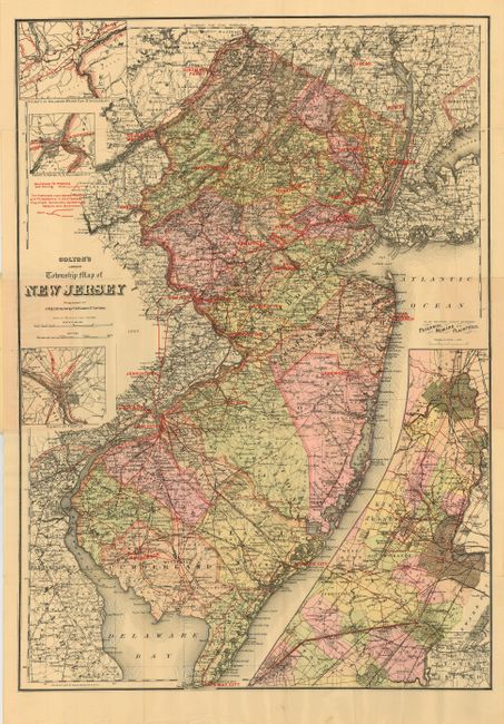
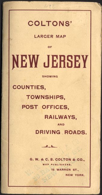
Subject: New Jersey

Period: 1897 (dated)

Publication:

Color: Printed Color

Size:
24.3 x 34.5 inches
61.7 x 87.6 cm
Download High Resolution Image
(or just click on image to launch the Zoom viewer)

This large folding map has remarkable detail and strong color. The entire map is criss-crossed with red overprinting showing the "Best Roads for Wheeling and Driving." A different red overprinting gives the "Preferred route between New York and Philadelphia." There is a large inset "Plan Showing Roads Between Paterson, Newark and Plainfield," plus three smaller insets detailing the vicinity of Delaware Water Gap, vicinity of Easton, Pa. & Phillipsburg, NJ, and vicinity of Trenton. The map is blank on verso and folds into original printed wrappers. Numerous road and bicycle maps also by Colton are listed on the back cover.

To our knowledge this map represents the latest known work of George W. and Charles B. Colton. In American Maps and Mapmakers, Ristow says there is no known output by the firm after 1892 and that it is unknown if the firm expired on that year or was taken over by another company. We find no other references to this map or any other from this period. A very late, possibly unrecorded Colton map. The firm gives their address at 15 Warren Street, New York.

References: Ristow p. 326.

Condition: A

Remarkable condition for a map of this size printed on thick paper. One fold intersection reinforced on verso with archival tape. A little soiling and seller's stamp on cover, else fine.

Estimate: $200 - $300

Sold for: $450

Closed on 9/20/2006

Archived