Catalog Archive
Auction 116, Lot 278

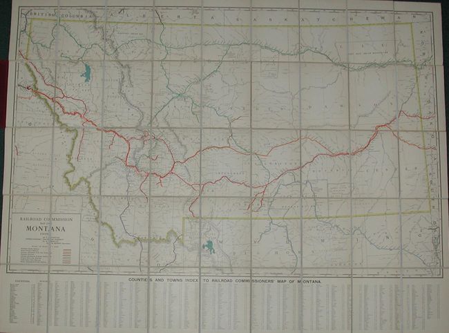
"Railroad Commission Map of Montana", Rand McNally & Co.

Subject: Montana

Period: 1908 (dated)

Publication:

Color: Printed Color

Size:
53 x 41 inches
134.6 x 104.1 cm
Download High Resolution Image
(or just click on image to launch the Zoom viewer)

This is a large sectionalized linen backed map of the state that folds into maroon cloth covers (6"x 8-1/2") with the title in embossed gilt lettering. The map is very detailed with the eight major railroads highlighted in color and keyed to the legend. Locates all towns and villages, Indian Reservations, National Forests, and more. It extends south to include part of Wyoming and Idaho to about Jackson Lake and all of Yellowstone Park. Across the lower portion of the map is a large town and county index keyed to the map. The map was engraved and published by Rand McNally for the Montana Railroad Commission. Names B.T. Stanton, Nathan Godfrey, and E.A. Morely as commissioners, and H.K. Howry as secretary.

References:

Condition: A+

Bright color and strong impression. Original linen in fine condition. Cover and gilt titling as new. A flawless example.

Estimate: $350 - $450

Sold for: $900

Closed on 9/20/2006

Archived