Catalog Archive
Auction 116, Lot 237

"Map Showing the Distribution of the Indian Tribes of California", U.S. Department of Interior
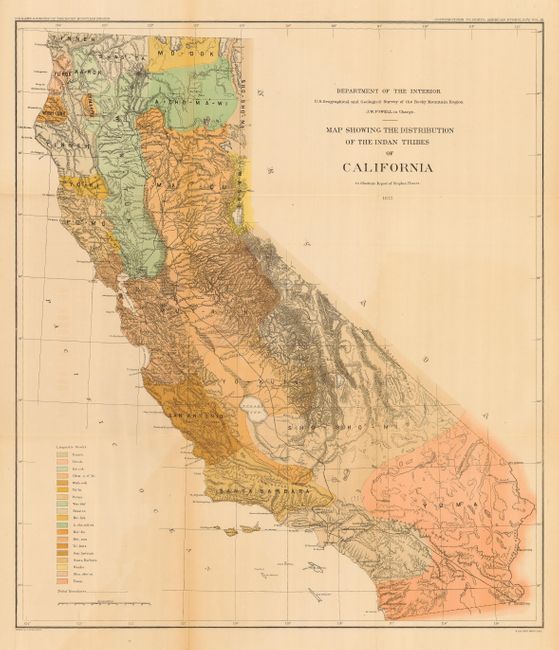
Subject: California

Period: 1877 (dated)

Publication: Tribes of California

Color: Printed Color

Size:
22.3 x 25.5 inches
56.6 x 64.8 cm
Download High Resolution Image
(or just click on image to launch the Zoom viewer)

This large, colorful and historically important map was compiled under the direction of J.W. Powell. It is from Volume III - Contributions to North American Ethnology of Steven Powers' report. Powers is considered California's first Ethnologist. This map is a detailed examination of the Indian tribes throughout the state. The extensive legend provides the key to the coloring of the tribes, which identifies nineteen Linguistic Stocks. There is good detail of the existing railroads between Ft. Yuma and the Los Angeles area, and up the central valley to Sacramento and north to end at Shasta. This colorful map was drawn by H. Lindenkohl and lithographed by the venerable firm of Julius Bien.

References:

Condition: A

Folding, as issued with full, original margins. In the blank Pacific is evidence of light offsetting, map is still very good.

Estimate: $200 - $300

Sold for: $160

Closed on 9/20/2006

Archived