Catalog Archive
Auction 116, Lot 225

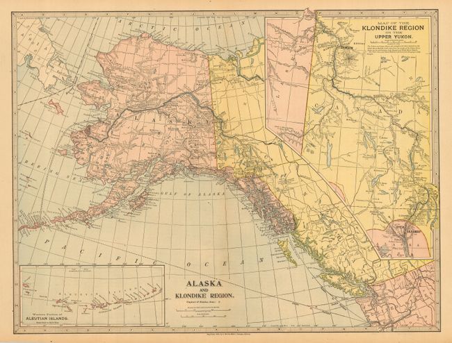
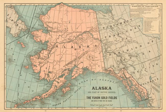
"[Lot of 2] Alaska and Klondike Region [and] Alaska and Part of British America, The Yukon Gold Fields and Routes by Which They Are Reached",

Subject: Alaska

Period: 1897-99 (dated)

Publication:

Color: Printed Color

Size:
See Description
Download High Resolution Image
(or just click on image to launch the Zoom viewer)

These maps relate to the Alaskan Gold Rush of the late 1800's. The first is an atlas map by J. Martin Miller, Chicago, 1899, 20 x 15". It includes a large inset at right "Map of Klondike Region on the Upper Yukon" that details the routes and gold fields of the area between Skagway and north to Dawson and the Klondike Gold region, and small inset map of the Aleutians. Steamer routes between Seattle, Vancouver, and Portland to several locations in Alaska are shown. The second map is by Mast, Crowell & Kirkpatrick, New York and Chicago, 1897, 12.8 x 18.8". It shows all of Alaska, Northwest Territory and part of British Columbia. It includes a route to the Gold Fields via the Yukon River. With a table of distances to the Yukon Region at upper left. Printed both sides, there is a map of Cuba on verso.

References:

Condition: A

Both are folding as issued and near fine.

Estimate: $70 - $80

Sold for: $65

Closed on 9/20/2006

Archived