Catalog Archive
Auction 116, Lot 184

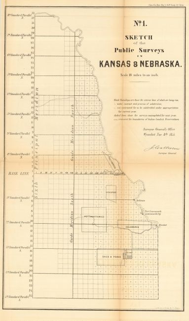
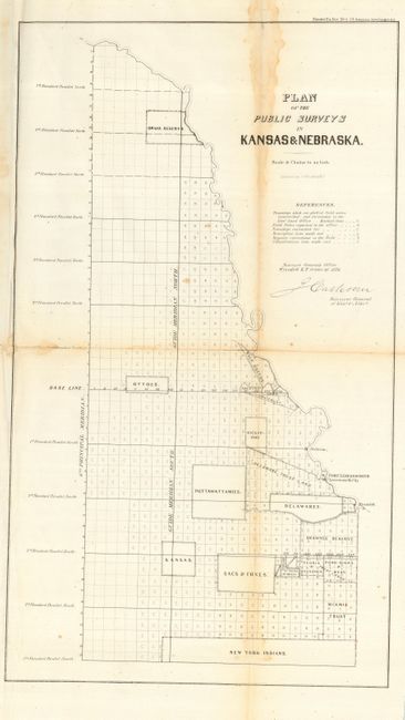
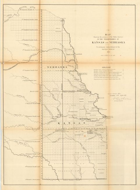
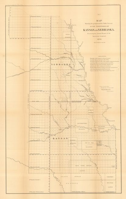
"[Lot of 4 - Kansas & Nebraska]", U.S. State Surveys

Subject: Midwestern United States, Kansas, Nebraska

Period: 1855-558 (dated)

Publication:

Color: Black & White

Size:
See Description
Download High Resolution Image
(or just click on image to launch the Zoom viewer)

This great lot includes the first four maps issued by the Surveyor General (1855-57 J. Calhoun and 1858 Ward B. Burnett) of the region. Calhoun has signed his maps in the plate. The maps show the rapid progress of surveys in the region:

1) No. 1. Sketch of the Public Surveys in Kansas & Nebraska, 1855 (11.8 x 20") Sen. Ex. Doc. No. 1, 34th Congress, 1st Session.
2) Plan of the Public Surveys in Kansas & Nebraska, 1856 (11.5 x 19.8") Sen. Ex. Doc. No. 5, 34th Congress, 3rd Session.
3) Map Showing the Progress of the Public Survey in the Territories of Kansas and Nebraska, 1857 (16.5 x 23.1") Sen. Ex. Doc. No. 11 & Ho. Ex. Doc. No. 2, 35th Congress, 2nd Session.
4) Map Showing the Progress of the Public Surveys in the Territories of Kansas and Nebraska, 1858 (14.3 x 23.3") Sen. Ex. Doc. No. 1 & Ho. Ex. Doc. No. 2, 35th Congress, 2nd Session.

References:

Condition: B

Folding, as issued. The 1857 map has some long splits along folds. The 1855 & 56 maps have a little toning at folds, the 1858 map is very good.

Estimate: $120 - $140

Sold for: $120

Closed on 9/20/2006

Archived