Catalog Archive
Auction 116, Lot 180
"Report of a Geological Exploration of Part of Iowa, Wisconsin, and Illinois…", U.S. Government
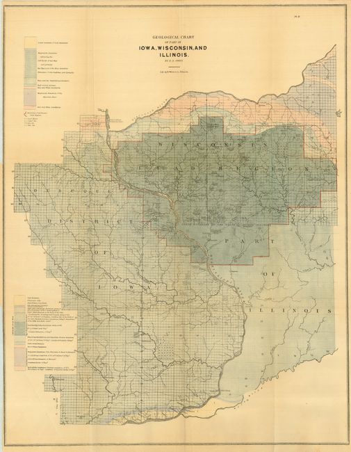
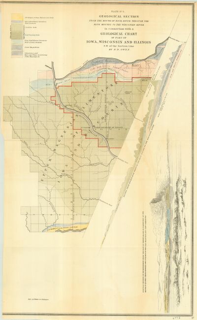
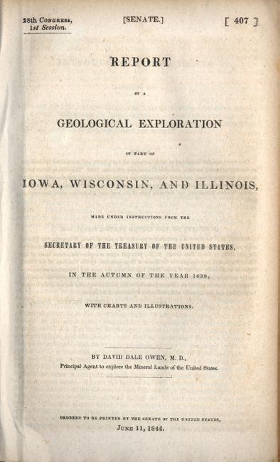
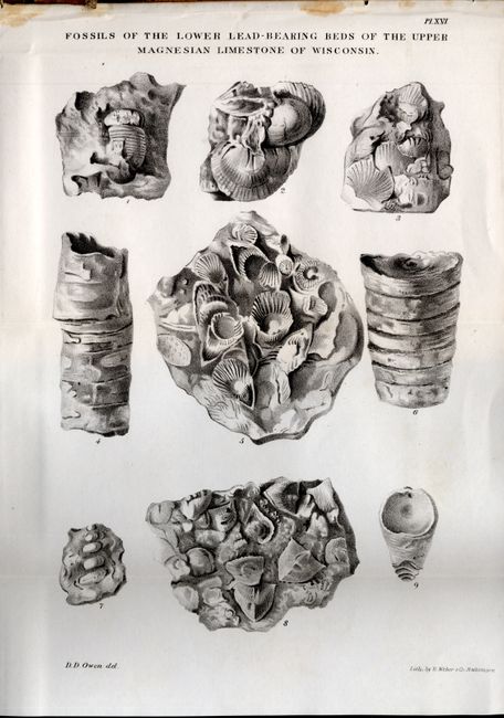
Subject: Midwestern United States, Iowa, Wisconsin, Illinois
Period: 1844 (published)
Publication: Sen 407, 28th Cong. 1st Sess.
Color: Hand Color
Size:
5.5 x 9 inches
14 x 22.9 cm
Download High Resolution Image
(or just click on image to launch the Zoom viewer)
(or just click on image to launch the Zoom viewer)