Catalog Archive
Auction 116, Lot 158

"Il Maryland, Il Jersey Meridionale, la Delaware, e la Parte Orientale della Virginia, e Carolina Settentrionale", Zatta, Antonio

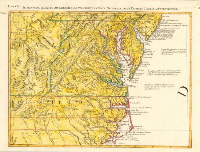
Subject: Colonial Mid Atlantic

Period: 1778 (published)

Publication: Atlante Novissimo

Color: Hand Color

Size:
16.8 x 12.5 inches
42.7 x 31.8 cm
Download High Resolution Image
(or just click on image to launch the Zoom viewer)

This great regional map extends from Philadelphia and the Delaware Bay, south to Cape Lookout and the Welsh Settlement in Carolina. To the west it shows all of the Allegheny Mountains and a large portion of the Ohio River. The map includes remarkable detail of towns, villages, roads and trails, and watershed topography. Drawn from the earliest available English and indigenous surveys, this is the Italian edition of Mitchell's seminal map of the British Dominions in North America that Zatta issued in 12 sections with the whole titled "Le Colonie Unite dell' America Settentrle." Zatta's maps retain Mitchell's scale, but being smaller are more legible. Zatta's map was used as late as 1932 in evidence in a boundary dispute between Delaware and New Jersey.

References: Portinaro & Knirsch #151; Sellers and Van Ee #163.

Condition: A

Near fine example on thick hand laid paper with adequate margins that appear to be original. Later full wash coloring in yellow added to original outline color.

Estimate: $500 - $600

Sold for: $375

Closed on 9/20/2006

Archived