Catalog Archive
Auction 116, Lot 140

"Phelps & Ensign's Traveller's Guide and Map of the United States Containing the Roads…", Phelps & Ensign

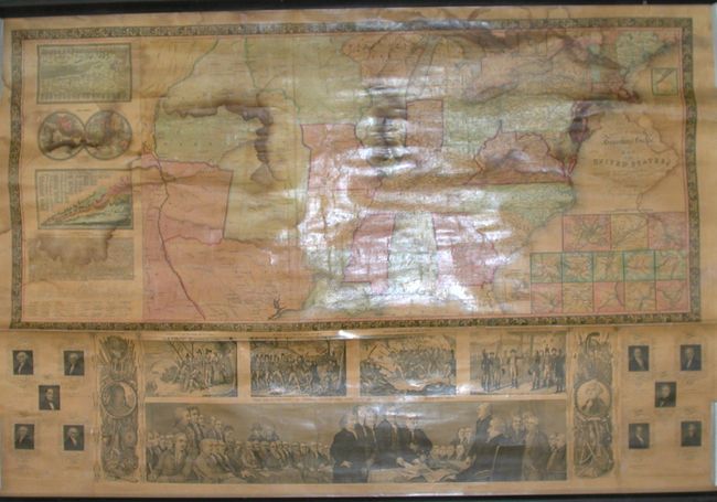
Subject: Eastern United States

Period: 1843 (dated)

Publication:

Color: Hand Color

Size:
39 x 28 inches
99.1 x 71.1 cm
Download High Resolution Image
(or just click on image to launch the Zoom viewer)

This is a scarce wall map version of Phelps & Ensign's important traveler's guide. It portrays the United States as far west as the Rocky Mountains depicting stage, steamboat, canal and railroad routes. Texas is shown as a republic. Thirteen small inset maps detail the vicinity of major cities, with two other insets of upper Maine and the Florida Peninsula. At left are a small double hemisphere world map and comparison charts of the mountains and rivers of the world. Other features of the map include several historical vignettes including the landing of the pilgrims, the battle at Lexington, the battle at Bunker Hill, Washington's farewell to his army and the signing of the Declaration of Independence, the text of the Declaration of Independence, and portraits of ten presidents. Backed with original linen with both original rollers attached.

References:

Condition: B

Some damp stains across top with some minor creases and cracks. Presentable as is, but would benefit from professional conservation.

Estimate: $1,000 - $1,400

Sold for: $900

Closed on 9/20/2006

Archived