Catalog Archive
Auction 115, Lot 91

"An Accurate Map of America, from the latest Discoveries", Gibson, John

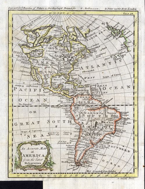
Subject: Western Hemisphere

Period: 1774 (circa)

Publication: Ye Beauties of Nature & Art diplay'd

Color: Hand Color

Size:
6.8 x 8.8 inches
17.3 x 22.4 cm
Download High Resolution Image
(or just click on image to launch the Zoom viewer)

The major focus of the map is on Admiral Bartholomew de Fonte and his exploration of the Pacific Northwest. In 1708, a newly discovered account of the Spanish Admiral's 1640 expedition was published. It was actually a hoax, but thereafter the account was changed and elaborated upon by numerous mapmakers. The extravagant claims included the discovery of the Northwest Passage and a huge Sea of the West, all shown on this map. The Sea of the West, here called the West Sea, is the notation "disc'd by I. Fuca 1592." The northwest portion of North America is ill-defined and gives information on a Russian exploration of Alaska in 1741, and other voyages by M. Spanberg in 1728. The east coast of America names each of the colonies, along with Williamsburg, Ft. Pitt, Savanna, St. Augustine and Boston. Virginia, the Carolinas and Georgia stretch to the Mississippi. There is a large interior Lake des Xarayes in central South America . Spanish South America includes Terra Firma, Amazonia, Peru, Paraguay, Chili and Magellanica. This scarce little map was "Engrav'd for Ye Beauties of Nature & Art diplay'd" and published by G. Robinson.

References:

Condition: A

Good impression and coloring with original margins. Binding trim at bottom left, as issued.

Estimate: $200 - $300

Sold for: $190

Closed on 6/21/2006

Archived