Catalog Archive
Auction 115, Lot 304

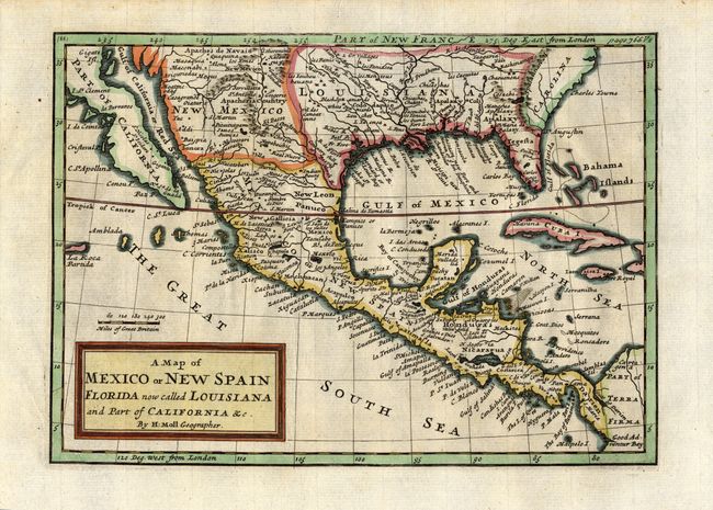
"A Map of Mexico or New Spain Florida now called Louisiana and Part of California &c.", Moll, Herman

Subject: Mexico and Southern United States

Period: 1717 (circa)

Publication: A Complete system of geography, ancient and modern

Color: Hand Color

Size:
10 x 7 inches
25.4 x 17.8 cm
Download High Resolution Image
(or just click on image to launch the Zoom viewer)

Uncommon, copper engraved map; the details throughout include many Indian names and early forts. Area extends from about the 37th parallel just to South America in Terra Firma. The only British colony shown is a large Carolina. The Spanish possession of Louisiana includes Florida and extends to the Rio Grande (here called the North River). Texas is not named but is inhabited by White and Black Spaniards, and Country full of Beevers. The Baja is distorted and the Gulf of California extends too far north, because Moll depicts California as an island on his other maps.

References: McLaughlin #180.

Condition: A

A lovely example that is near fine with wide margins and dark impression. Professionally encapsulated in archival Mylar.

Estimate: $375 - $425

Sold for: $650

Closed on 6/21/2006

Archived