Catalog Archive
Auction 115, Lot 254

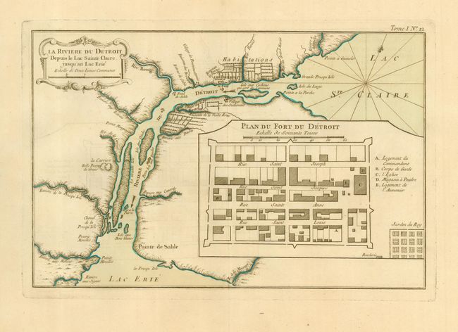
"La Riviere du Detroit Depuis le Lac Sainte Claire jusqu'an Lac Erie", Bellin, Jacques Nicolas

Subject: Michigan

Period: 1764 (circa)

Publication: Petite Atlas Maritime

Color: Hand Color

Size:
12.5 x 8.2 inches
31.8 x 20.8 cm
Download High Resolution Image
(or just click on image to launch the Zoom viewer)

This fine map is the first printed map of Detroit. It was published after the French had lost control of the Great Lakes forts to the British during the French and Indian War. It is based on two manuscript maps by Joseph Gaspard Chaussegros de Lery; "Plan du Fort Detroit" (1749) and "La Riviere du Detroit" (1752). The map depicts the Detroit River between Lake Erie and Lake St. Clair with farms along both banks, the location of the fort, settlements and Indian villages. The inset plan of the fort delineates the various streets and buildings within the fort's walls.

References: Tooley (Amer) p. 210 #114; Sellers & Van Ee #777; Karpinski (MI) p.154-5.

Condition: A

Original color. Bit of very faint offsetting that erases easily, else very fine.

Estimate: $1,800 - $1,900

Sold for: $1,700

Closed on 6/21/2006

Archived