Catalog Archive
Auction 115, Lot 220

"Department of the Missouri. Sketch Showing Military Roads leading to Fort Lewis, Pagosa Springs", Ruffner, Lt. E.H.

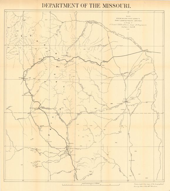
Subject: Colorado and New Mexico

Period: 1879 (dated)

Publication: HR doc 1, 46th Cong., 2nd Sess.

Color: Black & White

Size:
21 x 22.5 inches
53.3 x 57.2 cm
Download High Resolution Image
(or just click on image to launch the Zoom viewer)

This is the rarest of Ruffner's survey maps of southwestern Colorado - northwestern New Mexico. The area mapped is bounded on the north and east by the Rio Grande del Norte. To the west the map extends to Fort Lewis and Pagosa Springs and south into New Mexico past a cluster of settlements including Park View, Los Brazos, Old Fort Lowell, La Puente and Las Nutritas (sic). A road indicated with a dark line runs from Alamosa to Pagosa and south into New Mexico heading towards El Rite and Albuquerque. Several other roads cross the region, including the Chama and Conejos Toll Roads. Waterways are named, but topography is not shown, however random elevations are given. Drawn on a scale of four miles per inch. Tracings are attributed to maps from the Geographical Surveys West of the 100th Meridian.

References:

Condition: A

Issued folding, now backed with archival tissue. Slight toning along folds, still very good.

Estimate: $200 - $250

Sold for: $100

Closed on 6/21/2006

Archived