Catalog Archive
Auction 115, Lot 213

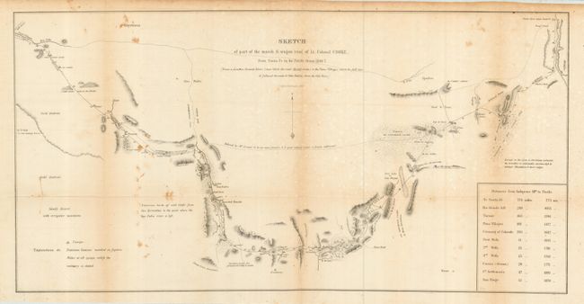
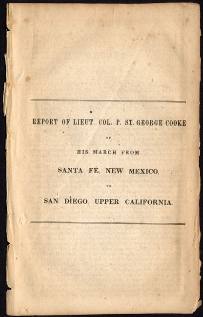
"Sketch of Part of the March & Wagon Road of Lt. Colonel Cooke, from Santa Fe, New Mexico, to the Pacific Ocean, 1846-7 [with] Report of Liet. Col. P. St. George Cooke of His March from Santa Fe, New Mexico, to San Diego, Upper California", U.S. War Department

Subject: United States - Southwestern

Period: 1847 (dated)

Publication: Senate Executive Document No. 23, 30th Congress, 1st Session

Color: Black & White

Size:
22.8 x 11.5 inches
57.9 x 29.2 cm
Download High Resolution Image
(or just click on image to launch the Zoom viewer)

In 1846, when Stephen W. Kearny led the Army of the West in the conquest of New Mexico and California he was accompanied by officers of the Corps of Topographical Engineers. Lt. W.H. Emory followed Kearny across the desert and produced the Expedition's main map. L. Col. Phillip, Lt. George Cooke and the "Mormon Battalion" took a more southerly route through the Guadeloupe Mountains and Tucson and produced this modest but important map. It records only the country he actually saw; the exception being a dotted line inscribed "Believed by M. Leoux to be an open prairie good route if water is found sufficient." Antoine Leroux was a famed mountain man who was acting as guide for the expedition, but he was wrong about that alternate route. Wheat finds this to be a "magnificent achievement" drawing public attention to a stretch deemed essential for a wagon and rail route that was later included in the Gadsden Purchase. The map terminates at the Pima Villages on the Gila (near present day Phoenix) where he picked up Kearney's trail. This lot includes the scarce original report by Cooke, consisting of the title page and pages 551 - 562, which are detached from the larger report printed as part of Senate Executive Document No. 23, 30th Congress, 1st Session.

References: Wheat (TMW) #505

Condition: B

Map with some toning along folds, and a few light stains.

Estimate: $250 - $300

Sold for: $140

Closed on 6/21/2006

Archived