Catalog Archive
Auction 115, Lot 16

"Navigationes Praecipuae Europaeorum ad Exteras Nationes", Scherer, Heinrich
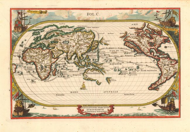
Subject: World

Period: 1700 (circa)

Publication: Atlas Novus … Part IV

Color: Hand Color

Size:
13.5 x 8.8 inches
34.3 x 22.4 cm
Download High Resolution Image
(or just click on image to launch the Zoom viewer)

Splendid map of the world on an oval projection showing California as an Island and a partially mapped Australia and New Zealand. This map is from the series produced by Scherer who was a mathematics professor and devout Jesuit. Unusually centered on the Pacific, it shows the sailing routes to the East Indies across the Pacific, around the Cape of Good Hope, and (optimistically) around a Northeast Passage to Japan. The corners of the map are richly decorated with sailing ships representing the major European powers: Britain, Holland, France and Spain.

References: Manasek #65; Shirley #631.

Condition: A

Near fine example with crisp impression and fine color on a sheet with full margins. Short printer's crease into border at upper left and a couple of insignificant spots, else fine.

Estimate: $1,600 - $1,800

Sold for: $1,400

Closed on 6/21/2006

Archived