Catalog Archive
Auction 115, Lot 163

"Amer. Sep. Partie des Etats Unis. No. 51", Vandermaelen, Philippe Marie Guillaume

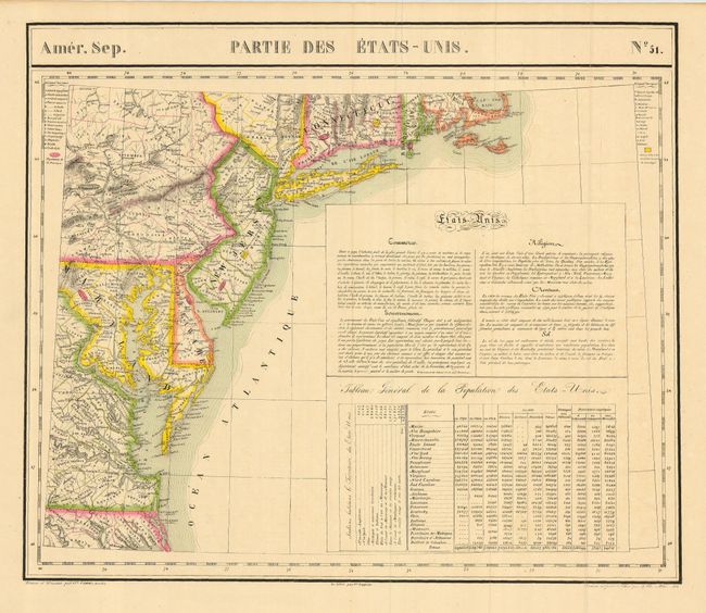
Subject: United States - Eastern

Period: 1825 (dated)

Publication: Atlas Universel

Color: Hand Color

Size:
22.3 x 19 inches
56.6 x 48.3 cm
Download High Resolution Image
(or just click on image to launch the Zoom viewer)

This finely engraved and extremely detailed map covers the region from just south of the Chesapeake to Long Island, and up to Cape Cod, showing all or part of North Carolina, Virginia, Maryland, Pennsylvania, Delaware, New Jersey, New York and Long Island, Connecticut, Rhode Island, and Massachusetts. There is good detail of the Chesapeake and Delaware Bays and the counties, towns, rivers, roads, mountains, rivers, islands, etc. The map has extensive notes on commerce, government, religion, revenues and weather. A large table gives state by state populations, showing growth by decade for 1790, 1800, and 1810. Expanded details for 1820 include populations for whites, slaves and free blacks, as well as populations of non-citizens, and information on the type of employment, broken down by agriculture, commerce and manufacturing. Second table gives the total populations for Indians by state. The "Atlas Universel" contained 400 lithographed maps in 6 volumes. It was the first atlas to present all the maps on the same scale (1: 1,641,836). There was only one edition of this scarce atlas, published in 1825-27, and the subscription list shows that only 810 copies were sold.

References: Phillips (A) #747, Imago Mundi, Vol. 24

Condition: A+

Very fine impression and original coloring with full original margins. Professionally encapsulated in archival Mylar.

Estimate: $300 - $350

Sold for: $220

Closed on 6/21/2006

Archived