Catalog Archive
Auction 115, Lot 148

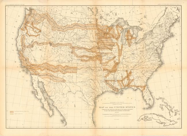
"Map of the United States Exhibiting the Grants of Lands Made by the General Government to aid in the Construction of Railroads and Wagon Roads", U.S. Department of Interior

Subject: United States

Period: 1878 (dated)

Publication: HR doc 73, 45th Cong., 2nd Sess.

Color: Printed Color

Size:
28.3 x 19.8 inches
71.9 x 50.3 cm
Download High Resolution Image
(or just click on image to launch the Zoom viewer)

The largest land give-away ever, Public Domain Land was granted by Congress to 19th century railroad barons to pay for construction of the railroad lines. Most - but by no means all - grants were west of the Mississippi River and ultimately totaled more than 174 million acres. Late in the century the practice became somewhat controversial, although by then it was too late. This map, published while John Wesley Powell was in charge of the Department, shows the grant areas within the United States. Vast swaths are colored, including virtually the entire state of Iowa. This is somewhat misleading as most grants were for alternate sections of land along the route of the road. The railroads were not able to sell all of these grants, however, and many reverted back to the government. A finely rendered map with lithography by Julius Bien. Published in the Report on the Lands of the Arid Region of the U.S. in the chapter titled "Land Grants in aid of Internal Improvements." A historical and desirable railroad map that may have been the source for a map used in an 1884 campaign poster by Democrats claiming a giveaway of public lands to special interests.

References:

Condition: B

Crisp impression and good color. On full sheet with original margins. Issued folding, now backed with archival tissue. A little fold line toning and some light color offsetting, else very good.

Estimate: $200 - $250

Sold for: $180

Closed on 6/21/2006

Archived