Catalog Archive
Auction 115, Lot 147

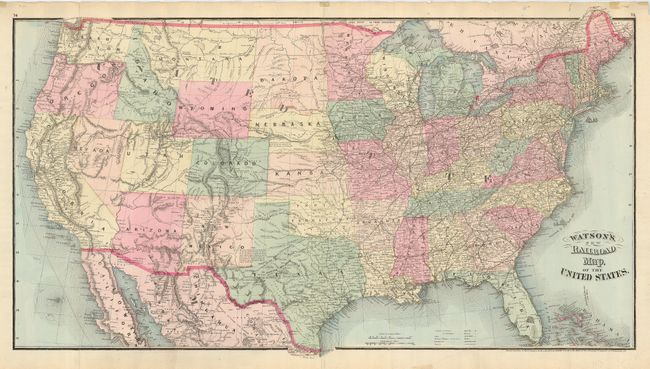
"Watson's New Railroad Map, of the United States", Watson, Gaylord

Subject: United States

Period: 1875 (dated)

Publication:

Color: Hand Color

Size:
30 x 17 inches
76.2 x 43.2 cm
Download High Resolution Image
(or just click on image to launch the Zoom viewer)

Large, detailed map issued just six years after the first transcontinental rail was opened. The number of lines and planned expansions is extraordinary and all are named. The map itself is very detailed and filled with information on political boundaries, towns, forts, watershed, and mountains. Delineates the Oregon Route, the Proposed Pacific Rail Road Route through the Southwest from Indian Territory to California, numerous military and exploration routes, and much more. Arizona is shown to include the southern portion of today's Nevada. Las Vegas is simply Vegas.

References:

Condition: B

One tear into map about 1" in blank ocean near Florida, closed on verso with archival tape. Numerous small marginal flaws, most closed on verso.

Estimate: $100 - $140

Sold for: $210

Closed on 6/21/2006

Archived