Catalog Archive
Auction 115, Lot 109

"Map of North America Exhibiting the recent discoveries, Geographical & Nautical", Wyld, James

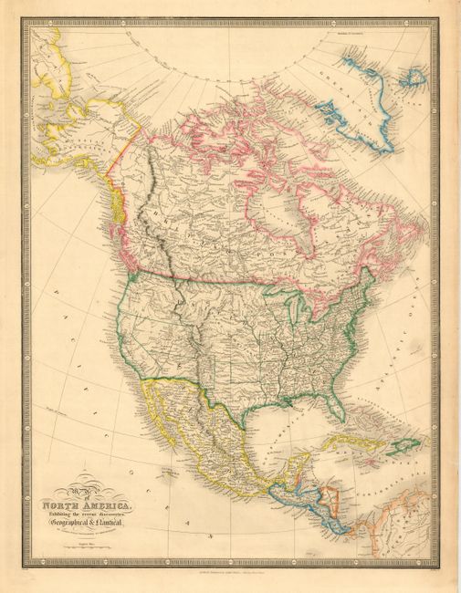
Subject: North America

Period: 1849 (circa)

Publication: Popular Atlas of the World

Color: Hand Color

Size:
14.5 x 19 inches
36.8 x 48.3 cm
Download High Resolution Image
(or just click on image to launch the Zoom viewer)

Finely engraved copper plate map filled with details and some interesting state and territory boundaries. Iowa is oddly shaped, Texas has a large panhandle incorporating the present-day Oklahoma panhandle, Missouri Territory takes in the Plains region, Oregon and Utah are shown at their largest extent, and New Mexico incorporates all of present-day Arizona and part of Colorado. Alaska is Russian Possessions and Canada is British Possessions. Keyboard-style borders.

James Wyld was successor to William Faden, one of the luminaries of late eighteenth century publishing in England. Wyld maintained the high standard of graphic and factual excellence that had been established by his predecessor and his maps are among the finest published in the early nineteenth century.

References:

Condition: A

Couple of minor tears in blank margins.

Estimate: $200 - $240

Unsold

Closed on 6/21/2006

Archived