Catalog Archive
Auction 114, Lot 633

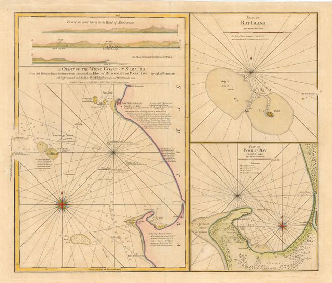
"A Chart of the West Coast of Sumatra from Old Bencoolen to Buffaloe Point [on sheet with] Plan of Rat Island [and] Plan of Poolo Bay", Laurie & Whittle

Subject: East Indies - Indonesia

Period: 1797 (dated)

Publication:

Color: Hand Color

Size:
23.5 x 20.3 inches
59.7 x 51.6 cm
Download High Resolution Image
(or just click on image to launch the Zoom viewer)

This fine sea chart is filled with important navigational information including soundings, anchorages, hazards, fishing works, watering places, three landfall approach views and two large plans of Rat Island and Poolo Bay. The charts cover the region of Bencoolen on the southwest coast of Sumatra, which was originally settled by the Dutch, and then conquered by the British in 1685 who built Fort Marlborough in 1710. The chart was originally drawn by Capt. Joseph Huddart with additions by John Price (1787) and Mr. McDonald (1793).

References:

Condition: B

Minor toning and a few light spots.

Estimate: $300 - $350

Unsold

Closed on 3/1/2006

Archived