Catalog Archive
Auction 114, Lot 592

"Great Tartary, The Isle of Japon", Moll, Herman

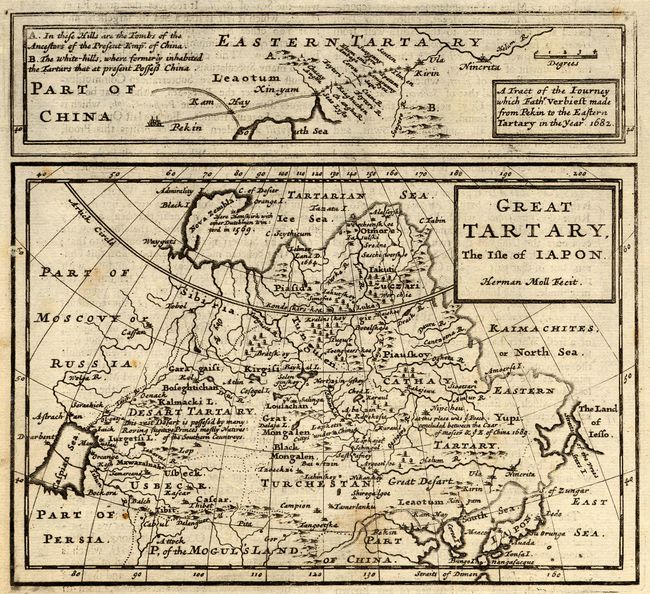
Subject: Northern Asia and Japan

Period: 1723 (published)

Publication:

Color: Black & White

Size:
7.3 x 6.5 inches
18.5 x 16.5 cm
Download High Resolution Image
(or just click on image to launch the Zoom viewer)

A nice copper engraved map of Northern Asia and Japan. Extends from the Caspian Sea and "Part of Moscovy or Russia" to Japan, up to Siberia and as far south as Korea and Northern Persia. Filled with place names including Mogul's Land, Great Desert, Tartary, Cathy, Yupi, Usbeck, Pekin, and much more. Locates the place the peace settlement was made between Russia and China in 1689. Korea, here Corea I., is shown as an island. The northern portions of Japan are indistinct with no clear coastline. Above the main map is a narrow map detailing the route taken by Father Verbiest between Pekin and eastern Tartary in 1682. On a sheet with English text below and on verso.

References:

Condition: B

Dark impression. A few scattered foxing spots, else very good.

Estimate: $120 - $160

Sold for: $65

Closed on 3/1/2006

Archived