Catalog Archive
Auction 114, Lot 37

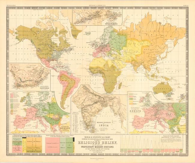
"Moral & Statistical Chart Showing the Geographical Distribution of Man According to Religious Belief with the Protestant Mission Stations…", Johnston, Alexander K.

Subject: World

Period: 1854 (dated)

Publication: Physical Atlas

Color: Printed Color

Size:
24.3 x 19.8 inches
61.7 x 50.3 cm
Download High Resolution Image
(or just click on image to launch the Zoom viewer)

This large map is a superb example of thematic mapping with various colors and diagrams used to illustrate the distribution of religions throughout the world. Through color, the map illustrates the predominate religions with the major categories being Catholics, Protestants, Mohammedans, Jews, and Heathens. Three insets show the distribution of Protestant Missions in India, South Africa and Canada. Two other insets show comparative charts of Europe for language and religion. This handsome chart is from the English version of Heinrich Berghaus' Physikalischer Atlas, which resulted in the first truly comprehensive thematic atlas. It is a very early example of printed color, the development of which made a huge impact on cartography in general and specifically the graphic portrayal of geographical data on thematic maps.

References: Phillips (A) #225; Robinson, pp. 64-67.

Condition: A+

Estimate: $200 - $250

Sold for: $160

Closed on 3/1/2006

Archived