Catalog Archive
Auction 114, Lot 311

"Map of Mexico, Central America, and the West Indies", Mitchell, Samuel Augustus

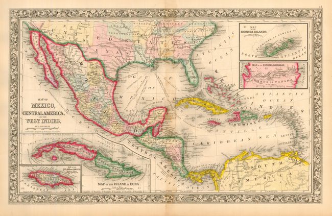
Subject: Gulf of Mexico and Caribbean

Period: 1860 (dated)

Publication: New General Atlas

Color: Hand Color

Size:
21 x 13.1 inches
53.3 x 33.3 cm
Download High Resolution Image
(or just click on image to launch the Zoom viewer)

This double-page map includes Texas and New Mexico Territory in pre-1863 configuration with no mention of Arizona. The map extends to include the southern states, all of the Caribbean and Bahama Islands, and a good deal of northeastern South America. Excellent detail throughout Mexico and Central America. The Baja Peninsula is here called Lower California. Four insets show Cuba, Jamaica, Bermuda Islands and a map of the Panama Railroad.

References:

Condition: B

Very fine impression, bright coloring and full, original margins. Map is fine less some scattered centerfold toning or staining.

Estimate: $100 - $140

Sold for: $75

Closed on 3/1/2006

Archived