Catalog Archive
Auction 114, Lot 308

"Carte du Golphe du Mexique et des Isles de l'Amerique", Bellin, Jacques Nicolas
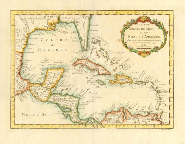
Subject: Caribbean

Period: 1754 (dated)

Publication:

Color: Hand Color

Size:
14.7 x 10.6 inches
37.3 x 26.9 cm
Download High Resolution Image
(or just click on image to launch the Zoom viewer)

Attractive map of the islands of the Caribbean that includes those parts of the United States & Mexico that border the Gulf of Mexico, Central America, and the northern coastline of South America. Routes of several explorers are shown with many coastal place names. Delicately engraved rococo-style title cartouche.

References:

Condition: B

Lovely old color. Couple of printer's creases and one tiny hole by cartouche resulting from a paper flaw. Folding as issued.

Estimate: $300 - $350

Sold for: $220

Closed on 3/1/2006

Archived