Catalog Archive
Auction 114, Lot 183

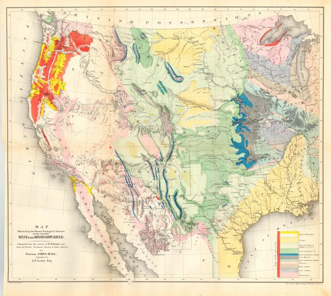
"Map Illustrating the General Geological Features of the Country West of the Mississippi River - Compiled from the Surveys of W.H. Emory and from the Pacific Railroad Surveys & other sources.", Hall, James
Subject: Western United States

Period: 1857 (dated)

Publication:

Color: Hand Color

Size:
23 x 20 inches
58.4 x 50.8 cm
Download High Resolution Image
(or just click on image to launch the Zoom viewer)

Great map of the western U.S. from the Ohio River Valley. Features original hand color with a legend showing pattern and color for eleven different geological formations. Filled with terrific detail of mountains, watershed, cities and roads. Extends to include the states of Sonora and Chihuahua in Mexico. Washington and Oregon appear to reach eastward to Nebraska, which in turn embraces a large territory north of Kansas. New Mexico includes present day Arizona. Likewise, Utah includes Colorado. A very handsome and colorful sheet that is becoming increasing difficult to find, particularly in this condition.

References: Wheat [TMW ] #922.

Condition: A

Folding, as issued. Beautiful coloring and fine impression. Very light hint of toning along one fold.

Estimate: $400 - $500

Sold for: $950

Closed on 3/1/2006

Archived