Catalog Archive
Auction 114, Lot 17

"Orbis Terrae Compendiosa Descriptio ex ea, quam ex Magna Universali Mercator Rumoldus fieri curabat in hac comodiore forma a Hieron: Porro redact:", Mercator/Magini
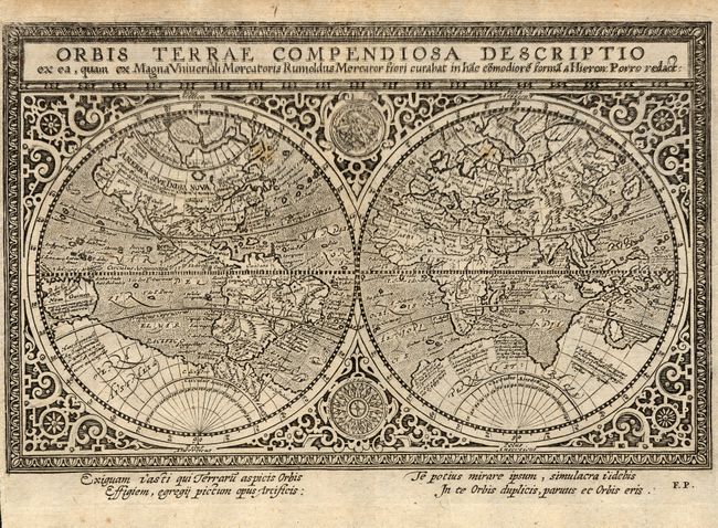
Subject: World

Period: 1597 (circa)

Publication:

Color: Black & White

Size:
9.5 x 6 inches
24.1 x 15.2 cm
Download High Resolution Image
(or just click on image to launch the Zoom viewer)

This double hemisphere world map is derived from the 1587 world map by Rumold Mercator and set within a similar strapwork background with an armillary sphere and compass rose tucked between the hemispheres. The North Pole is depicted as a landmass surrounding a sea from which four rivers radiate and there is a well depicted Northwest Passage. In the Antarctic is the imaginary southern continent and there is a bulge in the southwest coast of South America. The map was engraved by Girolamo Porro for Giovanni Magini and included in several of Magini's works, as well as those of Quad and Gothard in the early part of the seventeenth century. The map is finely engraved with stippled sea area, text in Latin below and blank verso.

References: Shirley #202.

Condition: B

The map was printed with a slight blurring of the top part of the map. Couple of small spots in map.

Estimate: $1,200 - $1,400

Sold for: $700

Closed on 3/1/2006

Archived