Catalog Archive
Auction 113, Lot 797

"Carta particolare dello stretto di Iezo fra l'America e I'Isola Iezo", Dudley, Robert (Sir)

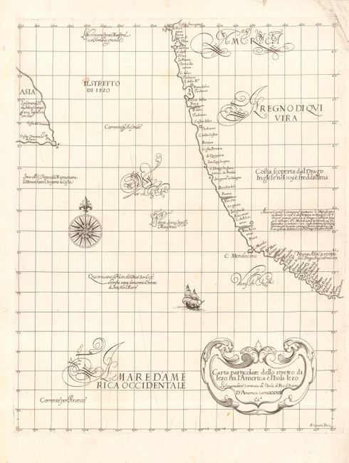
Subject: North Pacific Ocean

Period: 1661 (published)

Publication: Dell' Arcano del Mare

Color: Black & White

Size:
14.5 x 18.5 inches
36.8 x 47 cm
Download High Resolution Image
(or just click on image to launch the Zoom viewer)

An important map that is from the first atlas to print all maps on Mercator's Projection, the first to show winds, currents and magnetic deviation on its maps, and the first atlas of sea charts by an Englishman. The chart shows all of the American Pacific coast from about 38° north to Coste Incongnita and according to Burden is the first printed sea chart of the northwest coast of North America. Two notations record the English visit to this coastline in 1579 at Poto: di Nuoua Albion. Another notation near C: Mendocino at about 40° states that both Drake and some Spanish pilots found the cape to be at this latitude, but that others believe it to be closer to 50°. The strait between America and Asia is named IL STRETTO DE IEZO, an obvious reference to Japan. Beautifully engraved in the Florentine fashion by Antonio Francesco Lucini. This chart is the second state with L°.6°. added at bottom of title cartouche. Both states are rare according to Burden. Dudley was the son of privileged elite who had an interesting and varied life. There is a well written biography that details his life.

References: Burden #284; Wagner (NW) #352d.

Condition: A

Crisp, early impression on a fine sheet of hand laid paper with two watermarks. One tiny worm hole in blank ocean, one small spot, and some very light creasing across middle, else fine.

Estimate: $3,000 - $4,000

Sold for: $3,000

Closed on 12/7/2005

Archived