Catalog Archive
Auction 113, Lot 752

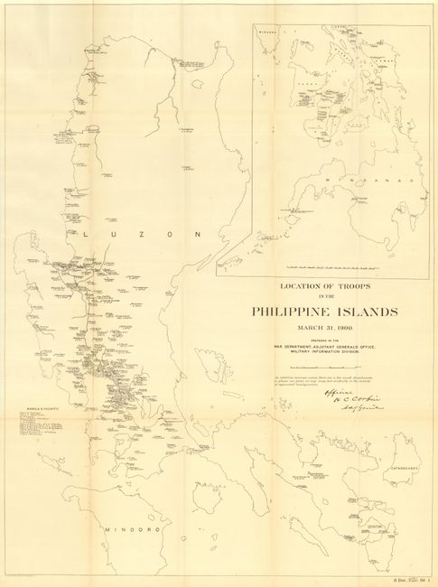
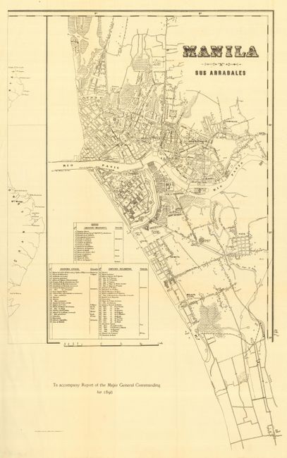
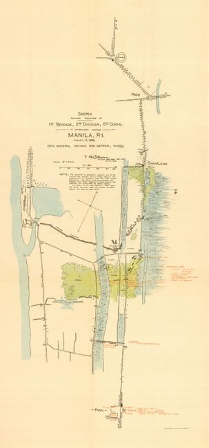
"[Lot of 4 - Philippines]", U.S. War Department

Subject: Philippines

Period: 1898-1900 (dated)

Publication:

Color:

Size:
See Description
Download High Resolution Image
(or just click on image to launch the Zoom viewer)

Collection of four maps relating to the Spanish-American War. The first, "Location of Troops in the Philippine Islands March 31, 1900" has two uncolored maps on one sheet. The larger map shows in great detail scores of troop positions by company and commanding officer throughout Luzon. A table gives major military divisions. The smaller inset map shows the islands to the south of Luzon on a smaller scale but with the same information. Signed in the plate by H.C. Corbin of the Military Information Division of the Adjutant General's Office. Published by the War Department in 1900 (21 x 28.2") Sen. Doc. 426, 56th Cong., 1st Session. Second map "Manila sus arrabales" is a finely detailed street map of Manila, 1898 (13.5 x 22") uncolored. The third map "Sketch showing positions of 1st Brigade, 2nd Division, 8th Corps. in operations against Manila, P.I. - August, 13, 1898 Brig. General Arthur Mac Arthur, Com'd'g" printed color (9 x 20.5"). The fourth map is "Map of the Operations Against Manila - Aug. 13, 1898" uncolored (7.5 x10.2").

References:

Condition: B

Folding, as issued. Hint of toning along a couple folds and some spots along on fold at lower left, else very good.

Estimate: $200 - $250

Sold for: $110

Closed on 12/7/2005

Archived