Catalog Archive
Auction 113, Lot 662

"Plano de la Peninsula de Zeuta y Campo de los Moros", Anon.

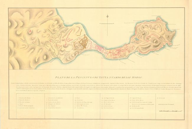
Subject: Mediterranean - Ceuta

Period: 1800 (circa)

Publication:

Color: Hand Color

Size:
28.5 x 18 inches
72.4 x 45.7 cm
Download High Resolution Image
(or just click on image to launch the Zoom viewer)

This is a very finely drawn manuscript map of Ceuta, a Spanish enclave on the coast of Morocco. Ceuta's strategic location on the Strait of Gibraltar has made it a crucial waypoint of many a culture's trade and military ventures. The fortifications are rendered in great detail with a key at bottom listing 30 important sites. Drawn in ink and hand colored with water color. Size includes Spanish text and key below map, which measures 28 x 10".

References:

Condition: A+

Estimate: $200 - $250

Sold for: $190

Closed on 12/7/2005

Archived