Catalog Archive
Auction 113, Lot 215

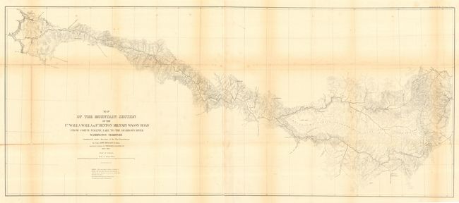
"Map of the Mountain Section of the Ft. Walla Walla & Ft. Benton Military Wagon Road from Coeur d'Alene to the Dearborn River", U.S. War Department

Subject: Northwestern United States

Period: 1859-1863 (dated)

Publication: Senate Doc 43, 37th Cong 3rd Sess.

Color: Black & White

Size:
49.5 x 21 inches
125.7 x 53.3 cm
Download High Resolution Image
(or just click on image to launch the Zoom viewer)

The Mullan Wagon Road was the most famous road ever constructed in the high Northwest, according to Wheat. A series of five maps were produced to show the path of the road. This map, the third of the series, is considered to be the most significant both from an historic and a technical viewpoint. Historically important for the illustration of developments in the region; gold mines, locations of La Barge City, Johnny Grants and habitations of early settlers such as Dempsey, Barr and Adams. It is also a technical tour de force as it was the " first ... general map using the contour method to represent topography ... in the west."

References: Wheat (TMW) #1079.

Condition: B

Issued folding, now backed with archival tissue. Light toning along some folds, some extraneous creasing.

Estimate: $180 - $220

Sold for: $210

Closed on 12/7/2005

Archived