Catalog Archive
Auction 113, Lot 172

"[Lot of 9 - Public Surveys]", General Land Office

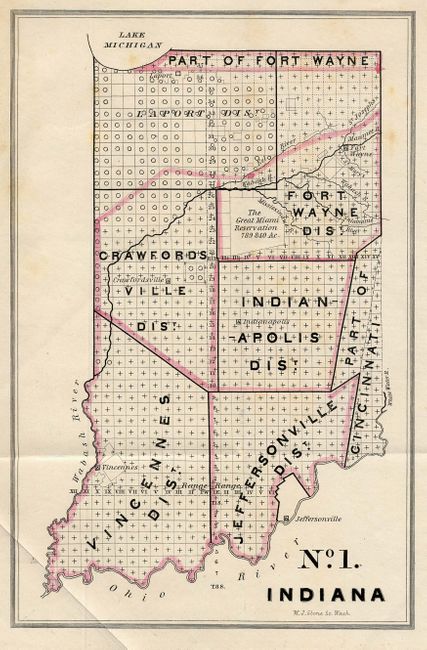
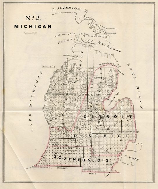
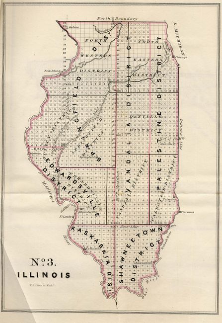
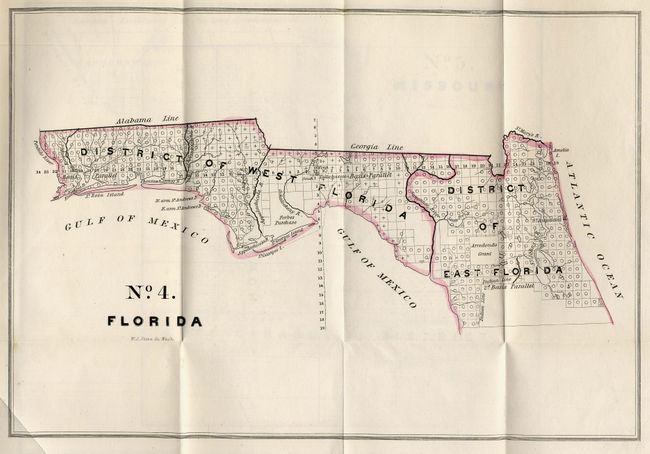
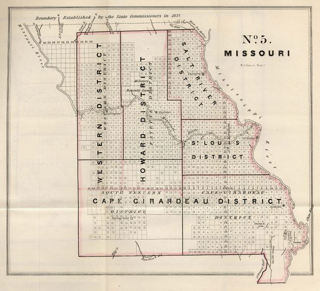
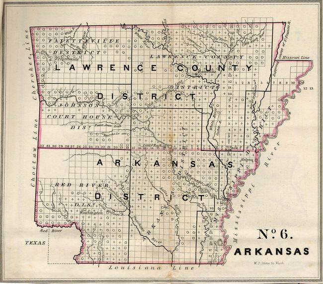
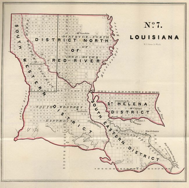
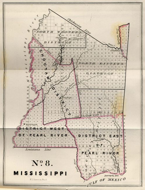
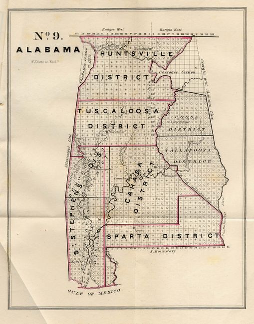
Subject: Eastern United States

Period: 1841 (published)

Publication: Senate Doc #92, 26th Cong., 2nd Sess.

Color: Hand Color

Size:
See Description
Download High Resolution Image
(or just click on image to launch the Zoom viewer)

A complete set of nine colored index maps to public lands for sale since 1828 in Illinois, Florida Territory, Missouri, Louisiana, Alabama, Indiana, Michigan, Mississippi and Arkansas. The maps are folded and bound together as originally issued. Each shows the districts as they existed in 1841. The Florida Territory map depicts only the northern part of Florida. Sizes vary: Indiana (5.5 x 8.4"), Michigan (8.8 x 10.4"), Illinois (7.8 x 11"), Florida (12 x 8.2"), Missouri (10 x 9"), Arkansas (8.5 x 7.3"), Louisiana (8.5 x 8.2"), Mississippi (6.4 x 8.5"), Alabama (7.8 x 9.7"). Maps are consistently titled "No. 1 . Indiana" through "No. 9. Alabama." All engraved by W.J. Stone.

References:

Condition: A

Still bound together with string as issued. No. 1 and the last three have occasional light scattered foxing, the other are fine. Folding, as issued.

Estimate: $150 - $200

Sold for: $100

Closed on 12/7/2005

Archived