Catalog Archive
Auction 113, Lot 130

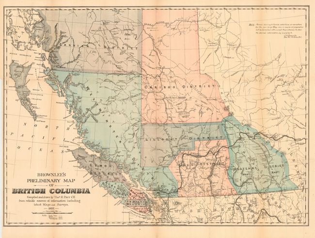
"Brownlee's Preliminary Map of British Columbia", Brownlee, J.H.

Subject: Canada

Period: 1891 (dated)

Publication:

Color: Printed Color

Size:
26 x 18.8 inches
66 x 47.8 cm
Download High Resolution Image
(or just click on image to launch the Zoom viewer)

Compiled and drawn by Thos. H. Parr, CE from reliable sources of information including latest Maps and Surveys. A colorful map of British Columbia shortly after completion of the Canadian Pacific Railroad to Port Moody (1885) and to Vancouver (1887). Names the Cassiar, Westminster, Lillooet, Cariboo, Yale and Kootenay Districts on the mainland, and the Comox, Alberni, Nanaimo, Cowichan, and Esquimalt Districts on Vancouver Island. The Fraser River and other hydrographic features of the region are well developed. A note offers the map for free upon application to Mr. Brownlee in Victoria for the purpose of sending in additions and corrections to be applied to the planned larger map. A scarce issue for which we only find an example in the Vancouver Public Library. The larger map was published in 1898 as "Brownlee's indexed map of British Columbia" of which several examples were found.

References:

Condition: B

Backed with archival tissue. Light toning along two folds, else very good to fine.

Estimate: $150 - $200

Sold for: $130

Closed on 12/7/2005

Archived