Catalog Archive
Auction 112, Lot 179

"Topographical Map of the Road from Fort Smith, Arks. to Santa Fe, N.M. and from Dona Ana N.M. to Fort Smith", Marcy, Capt. R.B.

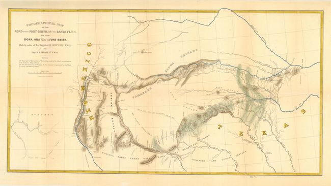
Subject: South-central United States - Texas

Period: 1850 (published)

Publication: HR Doc. 45, 31st Cong., 1st Session

Color: Hand Color

Size:
28.3 x 14.8 inches
71.9 x 37.6 cm
Download High Resolution Image
(or just click on image to launch the Zoom viewer)

Fine topographical map detailing for the first time the region along the Red River and the Canadian River. It shows two major roads from Fort Smith to Santa Fe, plus several other routes and Indian trails. Also notes various tribal lands, topography and hydrology as well as location of daily campsites. Filled with interesting details and notations including the Apache Trail and Comanche Trail - "Said to be a good route for wagons, with water daily." Very early depiction of Dallas. Published in the report on the Exploration of the Red River. Made by order of Bvt. Brig. Gen. M. Arbuckle, by Capt. R.B. Marcy, 5th U.S. Infantry.

References: Wheat (TMW) #681.

Condition: A

Attractive later color.

Estimate: $275 - $350

Sold for: $550

Closed on 9/28/2005

Archived